
Vecros: The Future of Autonomous Drones in Agriculture and Beyond
The world of drone technology is shifting from manual control to true intelligence. Leading this charge is Vecros, an Indian AI-based startup that recently made waves on Shark Tank with their flagship innovation:
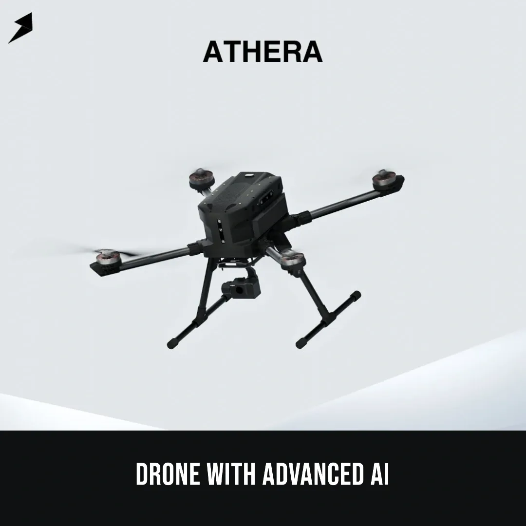
the Athera Drone.
While many drones are simply flying cameras, Vecros has built a machine that "thinks" for itself. Here is a look at how this spatial AI technology is changing the landscape of surveillance and smart farming.
What Makes the Athera Drone Different?
The standout feature of the Athera drone is its ability to operate autonomously. Unlike traditional drones that require a skilled pilot to navigate, Athera uses Spatial AI to understand its surroundings in real-time.
*GPS-Independent Navigation: Most drones fail when signals are weak. Athera can fly in "GPS-denied" environments, making it reliable for remote fields or dense industrial sites.
*360° Vision & Obstacle Avoidance: Equipped with multiple cameras, the drone senses obstacles from every angle and moves around them automatically.
*Human-Free Operation:It can navigate dangerous locations where it is too risky for humans to go, such as high-voltage power lines or damaged railway bridges.
Revolutionizing Agriculture with Smart Monitoring
For the modern farmer, the Athera drone is more than just a gadget—it is a sophisticated tool for Precision Agriculture. By integrating this AI into farming, the potential for "Smart Farming" becomes a reality:
*Crop Health Monitoring:Instead of walking through hectares of land, farmers can deploy the drone to identify specific patches affected by pests or diseases.
*Irrigation Management:The drone’s sensors can detect moisture levels, helping identify clogs in irrigation lines or areas suffering from water stress.
*Field Mapping:It creates high-resolution maps of the farmland, providing data that helps in better crop planning and soil management.
*Future Prospects: The technology is currently being adapted for precision spraying, ensuring that pesticides are only used where absolutely necessary.
Industrial Applications
Beyond the field, Vecros is solving high-stakes problems in several sectors:
*Infrastructure : Inspecting railway bridges and construction sites for structural cracks.
Energy: Monitoring oil and gas pipelines for leaks in difficult terrain.
Safety: Entering hazardous environments to provide real-time data without risking lives.
The Shark Tank Moment
*The Vecros journey saw a dramatic turn on Shark Tank. During the live demo, the drone unfortunately crashed—a moment that would usually end a pitch. However, the "Sharks" recognized the complexity of the Spatial AI software behind the hardware.
*Impressed by the technical depth and the massive market potential, Aman Gupta stepped in to provide the investment, proving that true innovation is valued even when the road to success has a few bumps.
SOURCE:Shark tank India
.jpg)
.jpg)
.jpg)