
Eyes in the Sky: How Satellite Mapping is Unlocking Telangana’s Fragmented Rice Fields
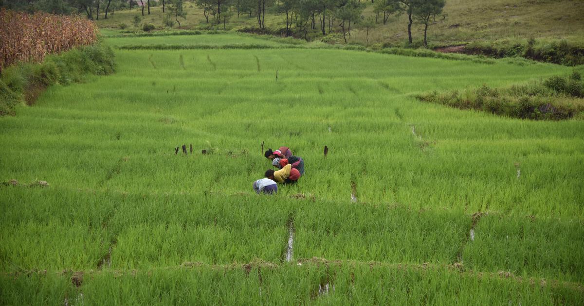
For decades, tracking exactly how much rice is growing across India has felt like a giant guessing game. In states like Telangana, where agriculture is heavily shaped by millions of tiny, independent family plots, traditional paper-and-ground surveys struggle to keep pace. How do you accurately measure a agricultural landscape where one farmer's plot is the size of a backyard, and their neighbor is planting weeks later?
A breakthrough study, "Satellite-based Rabi rice paddy field mapping in India: a case study on Telangana state," authored by researchers Prashanth Reddy Putta and Fabio Dell'Acqua, has introduced a smarter solution. By deploying a specialized, phenology-driven satellite classification framework across 32 districts in Telangana, the research demonstrates that space-age technology can successfully capture the chaos of smallholder farming with staggering precision.
The study managed to successfully map 732,345 hectares of Rabi rice with an overall accuracy of 93.3%. Here is how they did it, and what it means for the future of food security.
1. The Nightmare of Fragmented Landscapes
Standard satellite mapping algorithms are usually designed for massive, uniform corporate mega-farms like those in the United States or Brazil. When you apply those same broad filters to India, the data completely breaks down.
-
Tiny Plots: The study highlighted that individual fields in Telangana range from a modest 2.94 hectares down to a microscopic 0.01 hectares. When fields are that tiny, satellite pixels mix together, making it incredibly easy to mistake a wet paddy field for a swamp or a patch of wild grass.
-
The 50-Day Delta: Farmers don't all plant on the same day. Depending on when water is released from local lift irrigation projects or canals, the timing of the crop cycle—known as phenology—varies by up to 50 days from one district to another. A generic satellite snapshot taken in February might see peak green crops in one area and completely empty fields in another.
2. Switching to District-Specific Coding
To overcome this, the researchers threw out the traditional "one-size-fits-all" regional clustering approach. Instead, they calibrated their satellite processing parameters individually for every single district.
This localized calibration led to a massive breakthrough:
-
Tracking the True Lifecycle: The algorithm was programmed to track the distinct spectral signatures of a rice crop’s life: from the puddled, flooded fields of initial land preparation, through the rapid vegetative growth phase, up to the peak canopy greenness of the reproductive stage.
-
The North-South Divide: The data captured a fascinating geographic variance. Northern districts required extended land preparation phases lasting up to 55 days, while Southern districts showed highly compressed, fast-tracked cultivation cycles.
-
Bumping the Accuracy Baseline: This hyper-local tailoring resulted in a 8.0 percentage point improvement in data accuracy compared to traditional regional clustering methods, achieving a near-perfect correlation ($R^2 = 0.981$) when cross-verified with official ground-truth government statistics.
3. Confronting the "Tiny Field" Limitation
While the framework proved to be incredibly successful, the study didn't shy away from exposing the final frontier of agricultural remote sensing: field size limitations.
-
The Resolution Drop: When evaluating field sizes, the researchers noted that accuracy dropped by 6.8 percentage points when moving from medium-sized plots to ultra-small, fragmented fields.
-
Embracing Complexity: Rather than treating landscape complexity as an error to be smoothed over, the paper argues that future crop monitoring models must actively embrace this noise. Integrating higher-resolution data networks (like Sentinel-1 microwave radar and Sentinel-2 optical imagery) will be vital to capturing the absolute smallest smallholders.
"Remote sensing frameworks must learn to embrace rather than simplify landscape complexity if they want to serve practical policy and real-world food security."
.jpg)
.jpg)