
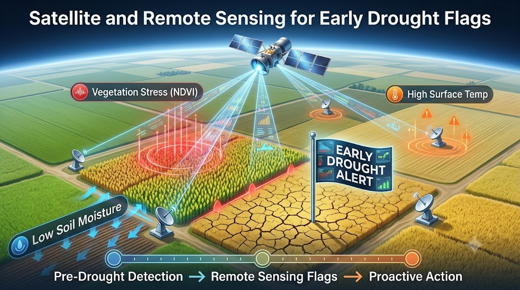
For generations, farming in India has been described as a "gamble with the monsoons." A delay in rains or an unannounced dry spell could quietly ruin acres of hard work before anyone fully realized the severity of the situation. Traditionally, relief and insurance measures only kicked into gear after the crops had already failed—a reactionary approach that often left smallholders financially devastated.
But the rules of the game are changing. Today, Indian policymakers and forward-thinking agritech companies are turning their eyes to the sky. By leveraging advanced remote sensing satellites and artificial intelligence, they are transforming how we anticipate, monitor, and manage regional crop health.
Instead of waiting for disaster to strike, the agricultural sector is shifting to a proactive strategy.
Spotting the Invisible Signs
The true power of this technology lies in its ability to see what human eyes cannot. Long before a plant visibly wilts or turns brown, its cellular structure changes when it faces moisture stress. Satellites orbiting miles above the Earth can detect these subtle shifts in light reflection and chlorophyll levels.
By running this continuous stream of satellite data through smart AI algorithms, platforms can now achieve incredible precision in three major areas:
-
Early Drought Flags: Predicting moisture stress weeks in advance, giving local communities and authorities a critical buffer to manage water resources or alter irrigation schedules.
-
Accurate Acreage Calculation: Instantly tracking exactly how many acres of a specific crop have been planted across a district, eliminating guesswork and manual surveys.
-
Dynamic Yield Forecasting: Modeling how current environmental conditions will impact the final harvest numbers long before the cutting season begins.
Fast-Tracking the Safety Net
Beyond helping farmers adapt their crop planning in real-time, this data-driven approach is completely overhaulling agricultural insurance.
Historically, filing a crop insurance claim required physical verification—a slow, bureaucratic process where surveyors had to visit fragmented plots manually. This often meant farmers waited months for payouts during their time of greatest need.
Now, localized agritech insurance providers are utilizing these undeniable satellite records to verify regional damage instantly. By bypassing traditional bottlenecks, they can fast-track claims and get financial relief into the hands of affected families in days rather than months.
A Resilient Future
By merging aerospace engineering with local agricultural insights, India is building a much stronger safety net for its rural economy. It’s a powerful reminder that while we may not be able to control the weather, we finally have the technology to make sure our farmers are never caught off guard.
.jpg)
.jpg)